
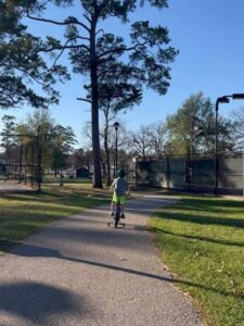
Across the Greater West Houston region, growth continues to move steadily westward. New neighborhoods, schools, and commercial centers are emerging across western Harris County and into Waller and Fort Bend Counties. As this growth unfolds, the region has an opportunity to think carefully about the kinds of infrastructure that will shape the communities of the future. Roads, drainage, and utilities remain essential, but another form of infrastructure is increasingly important as well: connected parks and trails.
One idea gaining traction is the concept of a West Houston Trail System that would link major open spaces across the region. A potential connection between John Paul Landing Park and Addicks Reservoir is one example, but the broader vision includes many possible connections. Trails could link communities along Langham Creek, Bear Creek, and Little Cypress Creek, connect neighborhoods to Terry Hershey Park and the Buffalo Bayou trail system, and create safe pathways between master planned communities, schools, parks, and commercial centers throughout the region. The goal is not a single corridor, but a network that gradually connects many of the places people already live, work, and recreate.
At its core, the idea is simple. As development continues to expand west of the reservoirs, there is an opportunity to connect parks, detention corridors, bayous, and green spaces into a continuous trail network that residents could use for walking, cycling, and outdoor recreation. Over time, such a system could stretch across multiple communities, linking neighborhoods with parks, schools, and commercial areas while also tying into larger regional trail networks.
In conversations about regional growth, trails are sometimes seen primarily as recreational amenities. Increasingly, however, communities across the country are recognizing that trail systems function as infrastructure in much the same way as roads or drainage systems. Well-designed trail networks support mobility by giving people safe, accessible options for short trips and daily recreation. They help improve public health by encouraging walking and cycling. They provide valuable green spaces in rapidly developing areas. And in many cases, they can be integrated with flood control corridors and natural drainage features to support environmental resilience.
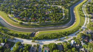
For a region like West Houston, where development often occurs across large master planned communities and along expanding transportation corridors, trails can also help create connections between places that might otherwise remain isolated from one another.
The corridor between John Paul Landing Park and Addicks Reservoir illustrates this opportunity well. Both locations are significant public open spaces. Connecting them through a broader trail network could create a backbone for additional connections throughout the surrounding communities.
One of the challenges of creating regional trail systems is timing. Growth across western Harris County and Waller County is accelerating, but many areas still have opportunities to incorporate trail corridors into future development patterns. By thinking about trail connectivity early, communities can identify potential alignments along bayous, drainage channels, utility corridors, and parkland. Over time, these pieces can come together to form a network that serves both existing residents and future generations.
This kind of approach has worked well in other parts of the Houston region. Investments in bayou greenways and connected park systems have helped transform how people experience the city’s waterways and open spaces. A West Houston trail system could build on those successes while responding to the unique geography and growth patterns of the western suburbs.
The first step in that process is understanding what already exists. To support that effort, WHA is working with LJA Engineering and other regional partners to map existing trails, planned trail segments, parks, detention corridors, and other potential pathways across the Greater West Houston region. We are working with Houston Parks Board, experts at creating trail systems using existing corridors such as along bayous and CenterPoint rights-of-way, to start looking at potential routes to connect existing trails. By creating a clearer picture of the current landscape, it becomes easier to identify where meaningful connections already exist and where gaps remain.
Once those gaps are identified, the next step is collaboration. In many cases, the land that could support trail connections is already publicly owned or controlled through existing infrastructure. Flood control channels, utility corridors, parkland, and reservoir edges often provide natural alignments for trails. In other locations, existing sidewalk improvements or planned roadway projects may provide opportunities to establish safe connections between communities and nearby parks.
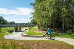
Municipal utility districts also play an important role in this conversation. Across the Greater West Houston region, many MUDs manage detention basins, drainage corridors, and open space areas that could potentially support trail segments. By working with these districts early in the planning process, it may be possible to incorporate trail connections into infrastructure projects that are already underway.
In some cases, filling a gap might require identifying easements or setting aside narrow corridors during the development process. In others, it may simply involve coordinating existing plans so that separate projects align with one another. The objective is not to impose a single design, but to help ensure that the individual decisions being made across the region gradually contribute to a larger, connected system.
This incremental approach reflects the reality of how infrastructure is built in a region as large and complex as Greater Houston. Trail systems often emerge piece by piece over time, as partnerships form and opportunities arise.
Trail systems also intersect with broader conversations about quality growth. Communities that integrate parks and trails into their design often see benefits that extend beyond recreation. Connected green spaces can increase property values, attract employers and residents seeking high-quality environments, and enhance the long-term stability of neighborhoods.
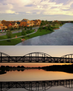
Developers increasingly recognize that trails are not simply amenities added at the end of a project. When incorporated early into the design of communities, they become organizing features that shape how neighborhoods connect internally and with surrounding areas.
A regional trail vision can help guide these decisions by identifying priority corridors and encouraging coordination across jurisdictional boundaries. In a region that includes multiple counties, cities, special districts, and private landowners, coordination is especially important.
Ultimately, the idea of a West Houston Trail System is more than a single project or corridor. It represents an opportunity to think about how open space, recreation, and mobility fit into the long-term future of the region.
As the Greater West Houston area continues to grow, decisions made today will shape how residents experience their communities’ decades from now. Planning connected parks and trails can help ensure that growth includes spaces where people can walk, cycle, and enjoy the natural environment alongside the region’s expanding neighborhoods and business centers.
Connecting places like John Paul Landing Park and Addicks Reservoir could become the backbone of that vision. Over time, additional connections could extend the network deeper into surrounding communities, creating a regional asset that supports health, recreation, environmental resilience, and quality development.
The conversation about the West Houston Trail System is still in its early stages. But by mapping existing assets, identifying gaps, and working with partners across the region, the West Houston Association hopes to help move that vision from concept toward reality.