Introducing Greater West Houston
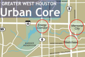 Greater West Houston, an area of approximately 1,000 square miles, is one of the fastest growing communities in the United States. It is characterized by large master planned suburban communities and urban-styled living environments. Greater West Houston (GWH) is anchored by three major regional activity centers: Energy Corridor, Westchase, and Memorial City (includes City Centre) forming the “urban core” of GWH. This core represents an employment base of approximately 150,000 with over 37 million square feet of office space-rivaling the Downtown CBD and Uptown/Galleria.
For twenty years the West Houston Association has produced a report about economic and demographic trends for the Greater West Houston region. Over the past few years this has included information about the population of the area as compared to the Houston Metropolitan Statistical Area (MSA). This year we have expanded the report to also cover more information about housing, in particular the future of housing based on lots under development and housing inventory. When examining the history of the region, know that jobs have followed rooftops. This means that information about the future of housing can be used to understand the future of employment.
Compared to the rest of the country and region, Great West Houston has developed quickly. It is home to more than 10 times as many people and more than 30 times as many jobs than it was 50 years ago. In 1970, Greater West Houston consisted mainly of rice farms, ranches, and rural towns with fewer than 180,000 residents and 18,000 jobs. By 1990 it had grown to over 700,000 residents and 242,000 jobs. Today, Greater West Houston is home to approximately 1,910,000 people and the location of over 590,000 jobs.
West Houston’s 1,000 square miles is spread across three counties. Approximately fifty percent of the region is within Harris County with the balance split between northern Fort Bend County and Waller County. Approximately forty percent of the greater West Houston region is inside the limits of City of Houston. Sixty percent of the Greater West Houston is within the City of Houston extra territorial jurisdiction (ETJ). There are 10 additional municipalities; 15 school districts; 11 special purpose districts and over 200 municipal utility districts in Greater West Houston.
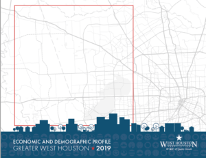
2022 Economic and Demographic Profile
Click image to view or download
Forecasting West Houston’s Demographic and Economic Future
Population and employment growth in Greater West Houston (GWH) from 1990 and forecasted to 2060 is the subject of the West Houston Association’s 2022 Demographic and Economic Profile. The West Houston Association maintains economic and demographic data on Greater West Houston and plans for its infrastructure needs based upon forecasted population and employment forecasts. CDS has been a key contributor providing WHA with data to help project regional growth out to the year 2060.
Growth Places Strong Emphasis on Need for Improved Infrastructure
As the forecast of population and employment data suggest, we see continued strong demand for all elements of the market in GWH-residential and commercial facilities. With GWH on track to nearly double its current population and employment base over the next forty years, strong emphasis must be placed on building and rebuilding the infrastructure to accommodate that growth. The following areas of focus where first identified in the West Houston Plan 2050 and are presented in the West Houston 2060 Plan as an update on progress and needed improvement.
Download a past Economic & Demographic Profile