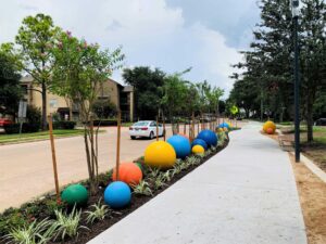
A short trip should not always require a car. Yet in parts of Greater West Houston, a missing sidewalk, a difficult crossing, or a trail that stops short of a destination can make driving the only practical choice. A person may be able to see a restaurant, bus stop, or park from where they stand but have no comfortable way to reach it without getting behind the wheel.
These gaps raise a larger question for a growing region: how do we make the transportation network more useful, rather than simply larger?
For decades, transportation planning in Greater West Houston focused on moving vehicles across long distances. That focus served a region shaped by outward growth, major employment centers, logistics activity, and communities spread across multiple counties. Roadway capacity and reliable freight movement remain essential. But as more people and destinations fill in the spaces between major corridors, the region also needs to consider the trips that happen within districts and neighborhoods, and the connections people make between different ways of traveling.
Multimodal planning considers driving, transit, walking, and biking as parts of one network. Its value lies less in promoting a particular mode than in understanding the full trip. A commuter may drive to a park-and-ride facility, take express transit, and walk the final distance to work. If the last crossing is unsafe or the sidewalk ends before the building entrance, the strength of the highway and transit connections cannot make up for that gap.
The same is true of shorter trips. A resident might reasonably walk to a nearby store if the route is continuous and comfortable. Without a safe crossing, that person may drive a mile or more to reach a destination only a few hundred feet away. An employee might walk to lunch from an office rather than move a car across a busy district. These individual decisions may seem small, but multiplied across a growing region, they affect traffic, parking demand, public health, and the experience of a place.
This is one reason multimodal mobility matters to economic development. Employers need workers to reach their facilities reliably, including people who work outside a typical nine-to-five schedule. Retail and service businesses benefit when nearby customers can reach them without making every visit a separate driving trip. Developers benefit when streets and public spaces help connect the uses within a project and the surrounding community.
Those benefits depend on context. A sidewalk along a high-speed roadway with no safe crossing may do little to improve access. A trail behind a commercial center may attract recreational users but contribute less to everyday mobility if it has no direct entrance to the businesses. A transit stop may serve a strong route yet remain difficult to use because the walk to it is exposed or indirect. Counting miles of sidewalk or trail tells us less than asking what destinations those miles connect.
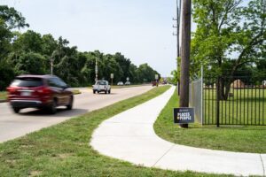
WHA’s recognition of Sidewalks 4 Precinct 4 points to the importance of filling everyday gaps. Sidewalk projects can be particularly valuable where they complete a route to a school, park, transit stop, or employment area. They also illustrate why coordination matters. A county may build one segment, a developer another, and a municipality a crossing. The trip works only when those pieces meet.
Road reconstruction presents similar opportunities. When a corridor is being rebuilt, the discussion can extend beyond pavement condition and vehicle capacity to consider intersections, crossings, drainage, and access to adjacent properties. That does not mean every road needs the same design. A freight corridor, a neighborhood street, and the main street of a mixed-use district perform different jobs. Good planning begins by understanding those jobs and designing for the people who use each corridor.
Safety is central to making any of these investments worthwhile. Many Greater West Houston roads carry substantial traffic at speeds that make walking or biking nearby uncomfortable. On those corridors, paint or a narrow strip of pavement may be insufficient. Appropriate separation, crossing locations, sight lines, and intersection design determine whether a route is one people will actually use. Safety also requires attention to the points where facilities meet: a trail crossing a road, a sidewalk reaching a driveway, or a bus rider navigating a large intersection.
Regional trails offer another way to think about connections. WHA’s recent discussions about West Houston trails have highlighted both the promise of existing projects and the challenge of linking them. A trail may serve as a valued recreational amenity while also providing a useful route to a park, school, or workplace. Its transportation value grows when it connects to the street network and continues across jurisdictional boundaries. A gap at a county line or property boundary may be small on a map but decisive for someone trying to make a trip.
In Greater West Houston, trail planning often intersects with drainage and open space. A corridor along a bayou or drainage facility may create opportunities for a trail, maintenance access, and linear park space. Combining those functions can make good use of limited land, but it takes coordination early in the planning process. Flood-control performance, access for maintenance, and public safety must guide the design. A trail in such a corridor may close during or after heavy rain, so it should be understood as part of the broader network rather than assumed to be available in every condition.
The relationship between mobility and land development deserves equal attention. Transportation patterns influence where businesses locate, how much land is devoted to parking, and whether neighboring uses feel connected. At the same time, development decisions determine whether future transportation connections will be easy or difficult to make. Reserving space for a trail connection or placing a building entrance where it can be reached from a sidewalk may be a modest decision during site planning. Retrofitting that connection years later can be costly or impossible.

This does not suggest that every part of Greater West Houston should develop in the same way. Distances between destinations vary, and many trips will continue to depend on driving. A practical multimodal strategy starts with places where another option could serve a meaningful number of trips: around schools and campuses, within employment districts, near parks and transit stops, and where neighborhoods sit close to commercial areas but lack a direct connection.
It also asks a different question when public and private projects are planned. Instead of considering only what happens within a project’s limits, we should ask what the project connects to. Could a reconstructed intersection make it possible to cross safely? Could a drainage project preserve a future trail connection? Could a development provide access to an existing path rather than turn its back on it? Could several small investments, made by different entities, complete a route that none could deliver alone?
For the West Houston Association, that way of thinking fits a longstanding commitment to quality growth and coordinated infrastructure. Greater West Houston will continue to need strong roads. It will also benefit from a more connected network around them: sidewalks that continue to destinations, trails that link communities, transit facilities people can reach, and streets designed for the trips they actually serve.
The most useful measure of progress may not be how many modes appear on a plan. It is whether more people can make more of their daily trips safely and reliably. Building that kind of network will take decisions across agencies, jurisdictions, and individual developments. Taken together, those decisions can make Greater West Houston easier to navigate and better prepared for its next stage of growth.
