
Portions of the West Houston Area within the City of Houston are the fastest growing and among the most densely populated.
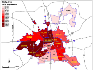
Population of Various Sections of the City of Houston
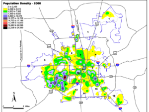
Population Density Map of the City of Houston
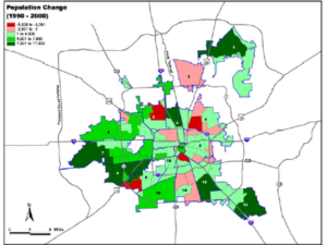
Houston – Highest Growth between 1990 and 2000
City of Houston 2000 Land Use & Demographic Profile–Executive Summary
Prepared by the Planning & Development Department of the City of Houston, this summary discusses the
demographic and land use changes in the City from 1990 to 2000.
City of Houston Planning Department documents how the City of Houston compares with several other US cities in demographics, public safety, housing and the economy in a 2005 report. Access the report by click this link.
Data and Economic Development Links
State of Texas Data Center
Real Estate Center, Texas A&M University
University of Houston Institute for Regional Forecasting
State of Texas Economic Development Office
Harris County Economic Development
Greater Houston Partnership
Fort Bend Economic Development Council
Katy Economic Development Council