
WHA’s Map App:
An ArcGIS Version of WHA’s Traditional Development Map with intuitive features and more layers. For Information on Log-In and Upgrades, contact WHA Staff.
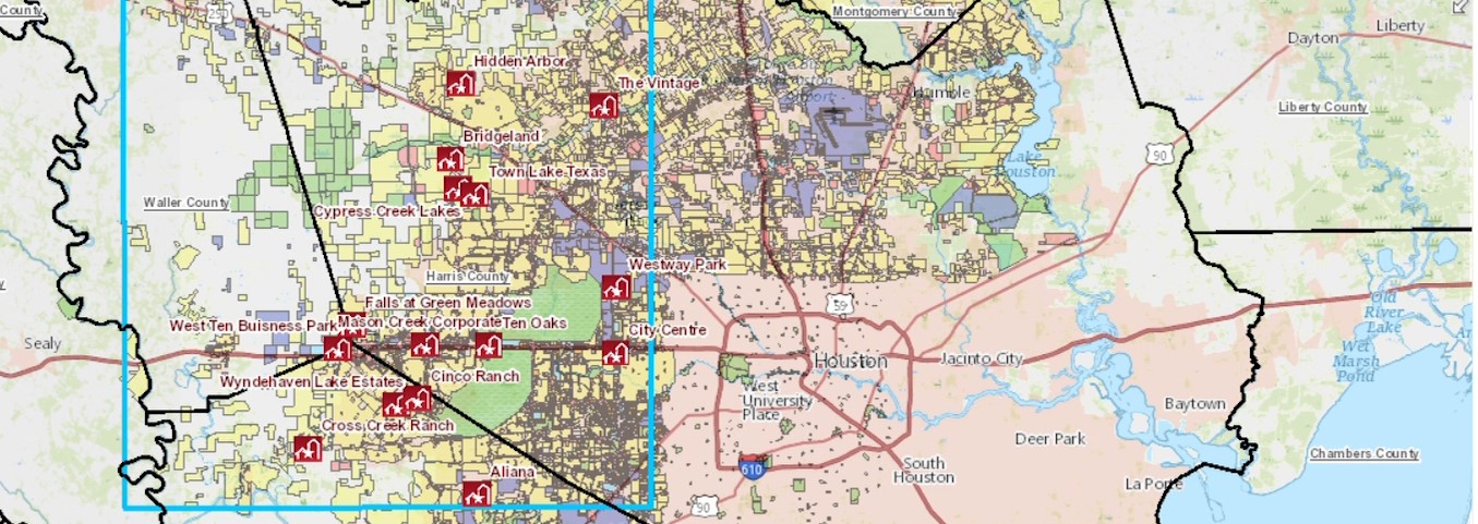
WHA’s Maps
Here at WHA we provide a variety of different maps that our members have worked very diligently to create and update. If you see one you would like to use purchase a print of, please click the button below and send or email the form back to us once filled out.
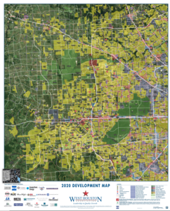
WEST HOUSTON 2020 MAP
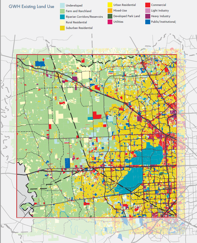
West Houston Existing Land Use Map
West Houston Population & Jobs Heat Maps
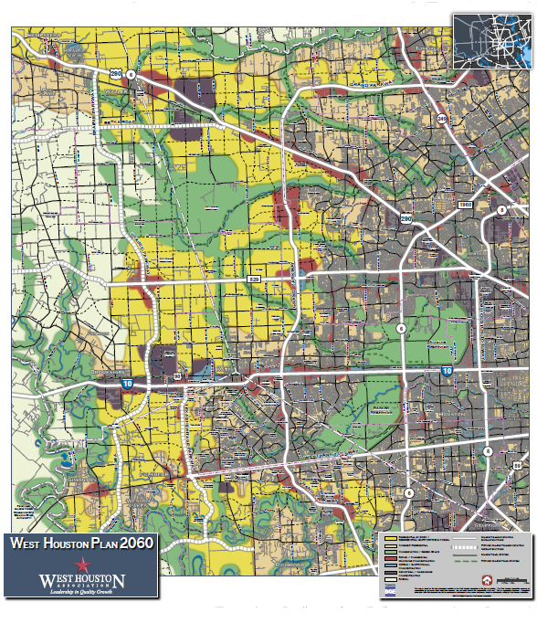
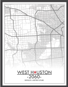
West Houston 2060 Land Use Map
Map Order Form
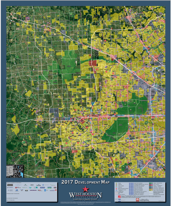
2017 WEST HOUSTON DEVELOPMENT MAP
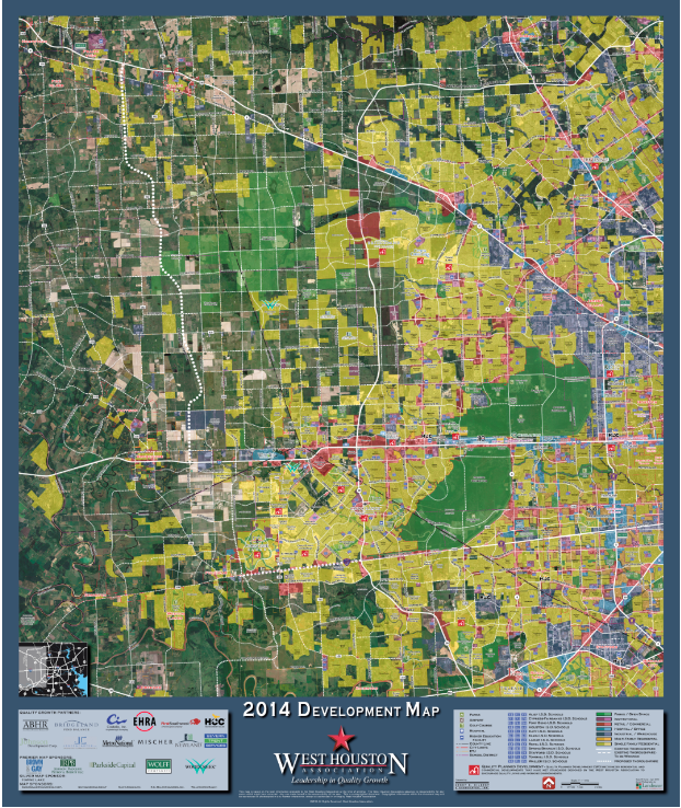
2014 WEST HOUSTON DEVELOPMENT MAP
Mapping the 1,000 Square Mile Greater West Houston
More Than A Development Map. Available in two sizes and six specialty maps including two favorites: School District Areas and Municipal Limits/ETJ’s
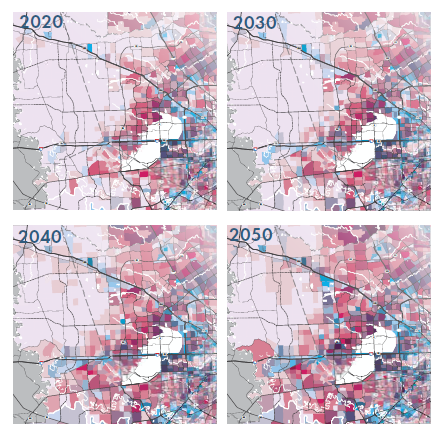
GWH 2050 LAND USE SCENARIO MAP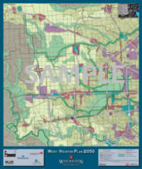
In 2050, WHA forecasts a population of 2.4 million and 1 million jobs for Greater West Houston. One question: “where will this growth be?” Our 2050 Land Use Map shows one likely land use scenario that will accommodate the growth we know is coming.
(Click Order Form For More Details, Samples, Pricing and Order Information on the Development and 2050 Land Use Map)
We accept Visa & Master Card. Please contact us for more information.
WEST HOUSTON 2060 PLAN
WEST HOUSTON Economic & Demographics Reports